With over 30 years’ experience of working in the aviation and emergency response sectors, Skyview Systems fully understands that ensuring safe air ambulance operations is paramount. Route planning is critical, especially in an emergency situation when timing is vital. With stringent safety legislation to adhere to and with patients’ lives in their hands – the stakes could not be higher for the air ambulance crew.
About Derriford Hospital
Derriford Hospital operates as part Plymouth NHS Trust. Plymouth Hospital is the largest hospital trust in the South West and offers a full range of services to around 450,000 people in Plymouth, North and East Cornwall and South and West Devon.
The hospital’s air ambulance helipad was officially launched in June 2015, with its first ever landing of a search and rescue helicopter. The helipad was funded by the County Air Ambulance HELP (Helicopter Emergency Landing Pads) Appeal, which has contributed £850,000 alongside £900,000 capital funding from the hospital Trust. Fast forward to 2019 and the air ambulance has made some 1,700 life-saving landings.
The Challenge
NHS Trusts must comply with rigorous legislation and need failsafe systems in place to provide expert life-saving care. Plymouth NHS Trust needed a weather system for the helipad at Derriford Hospital to monitor cloud height and visibility, temperature, humidity, wind speed and direction, barometric pressure and the facility for all data to be analysed through an internet-enabled PC.
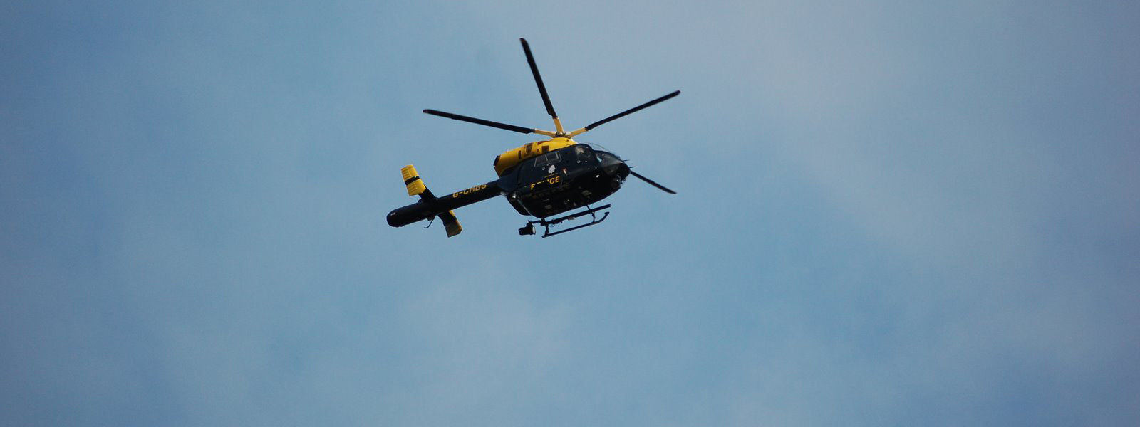
Adverse weather conditions can have a severe impact on flight safety. Cloud height and visibility and fog are crucial factors for emergency response teams, and along with other considerations, must be consistently and reliably monitored to ensure safety of all on board.
UK weather is changeable at any time of year, but this is of particular concern in winter months when the dew point and the temperature are close together. Cloud and fog can form in a very short period of time – which can be critical to safe operations. A pilot can leave base in good weather, but within 30 minutes this can be a very different story.
Where and when to land is a major consideration, and with a limited supply of fuel, any unplanned re-routing could be problematic. With an average of two hours flying time in some cases, and a practical range of 200 nautical miles one way in good weather, or 150 nautical miles in poor weather, every second counts in this high pressure situation.
Our Solution
Having worked with various air ambulance teams including East Midlands Air Support Unit, Devon Air Ambulance Trust and Royal Cornwall Hospital, we fully understand the challenges facing the emergency response sector. Our experienced Skyview engineers set to work to provide an efficient, safe and cost effective system to ensure that pilots can make critical flight safety decisions.
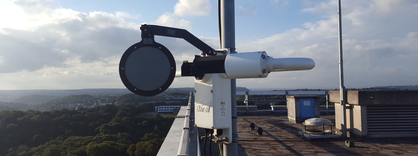
After consulting with the team at Plymouth NHS Trust, Skyview Systems commissioned a cloud, visibility and weather monitoring system to facilitate safe operations and flight planning for Derriford Hospital. We installed a professional weather station to measure wind speed, direction, temperature, humidity, barometric pressure and rainfall. A ceilometer using sophisticated laser technology was installed to measure cloud height and thickness for up to three cloud layers, with a measuring range of 25,000ft. A visibility sensor with a range of 10m to 20km was also installed. Data from the sensors is fed back to Skyview’s own SkyMet-i software, allowing current and historic data to be viewed immediately whenever needed.
Our yearly service and maintenance plan ensures that the equipment at Derriford always gives accurate readings and is in working order with traceable calibration certificates for legal compliance.
Skylink-pro
Skyview were delighted to welcome the Derriford team as users of our own feature rich real-time weather monitoring portal, Skylink-pro.
Skylink-pro has the facility to receive and query live cloud, visibility and weather data remotely or via SMS and includes national met data, satellite images, METARs, TAFs and charts, and with 15+ users, the operations team can view vital real-time data when they need it most.